blah blah blah
Big Ball Mountain
Length: 3.8 miles out-and-backDifficulty (click for info): Easy
Elevation Gain: 1470 feet (+100 feet on return)
Rating (click for info): 6/10
Elevation: 2062'
Prominence: 141'
Driving Directions:
Trailhead and parking area are on Rt. 25 in Tuftonboro, NH, 3.9 miles east of Rt. 109. Just east of Sodom Road, over a bridge, the parking area is on the north side of the road. It's a large dirt pull-in lot. There is no sign marking it. Click here for a Google map.
About the Hike:
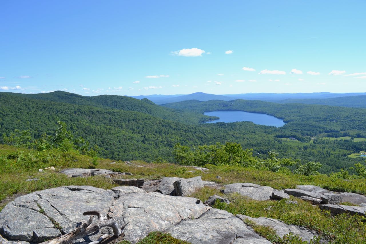
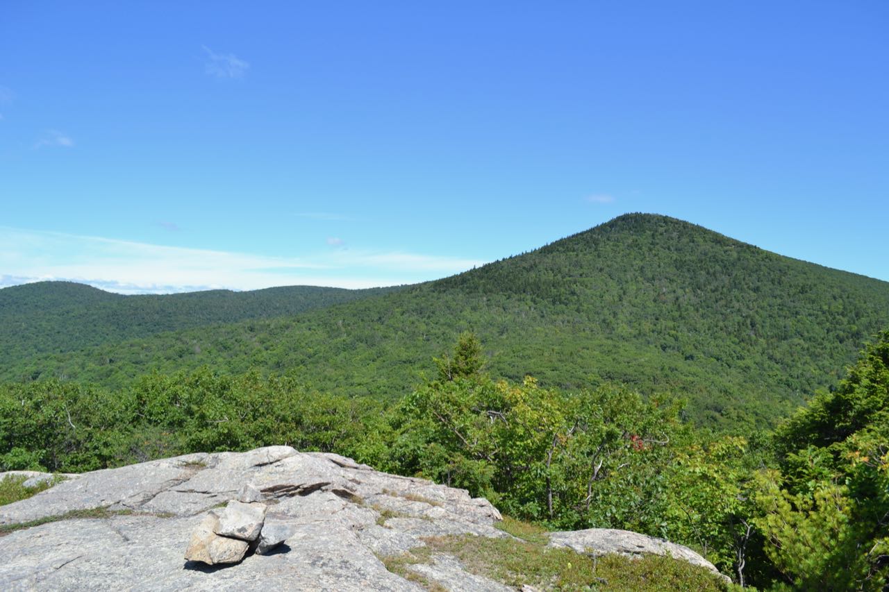
Big Ball Mountain, also known as Tate Mountain, is a ledgy spur on a southern ridge of Mt. Shaw in the Ossipee Mountains. The mountain is one of the destinations within an extensive network of privately-owned hiking trails on the southern and eastern slopes of the Ossipees. The peak is also recognized on the unofficial "Ossipee 10" hiking list as one of the nicest destinations in the mountain range. Many scenic ledges on the mountain provide views of the Lakes Region as well as the higher peaks of the Ossipees nearby.
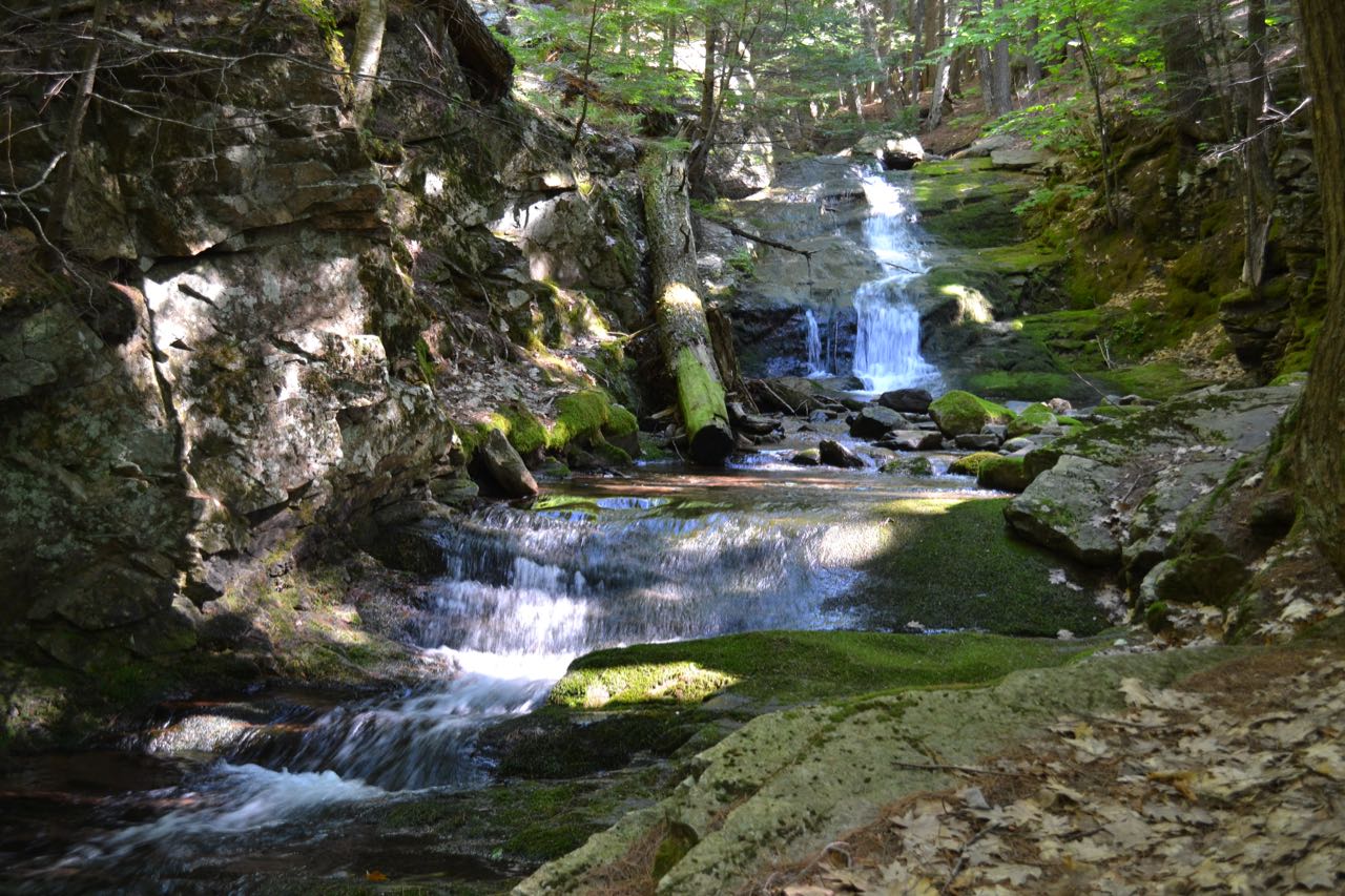
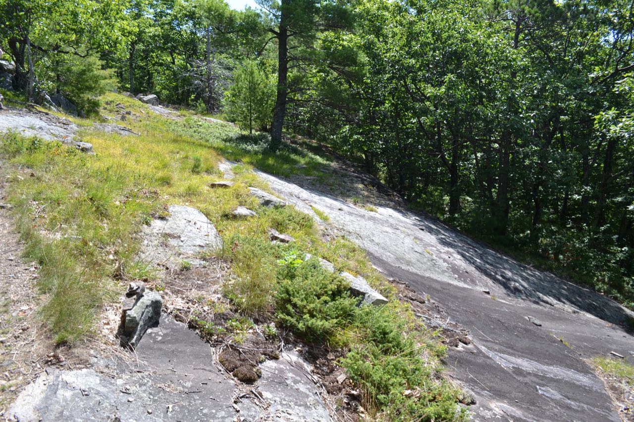
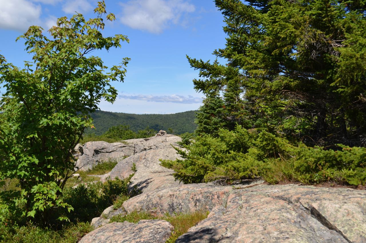
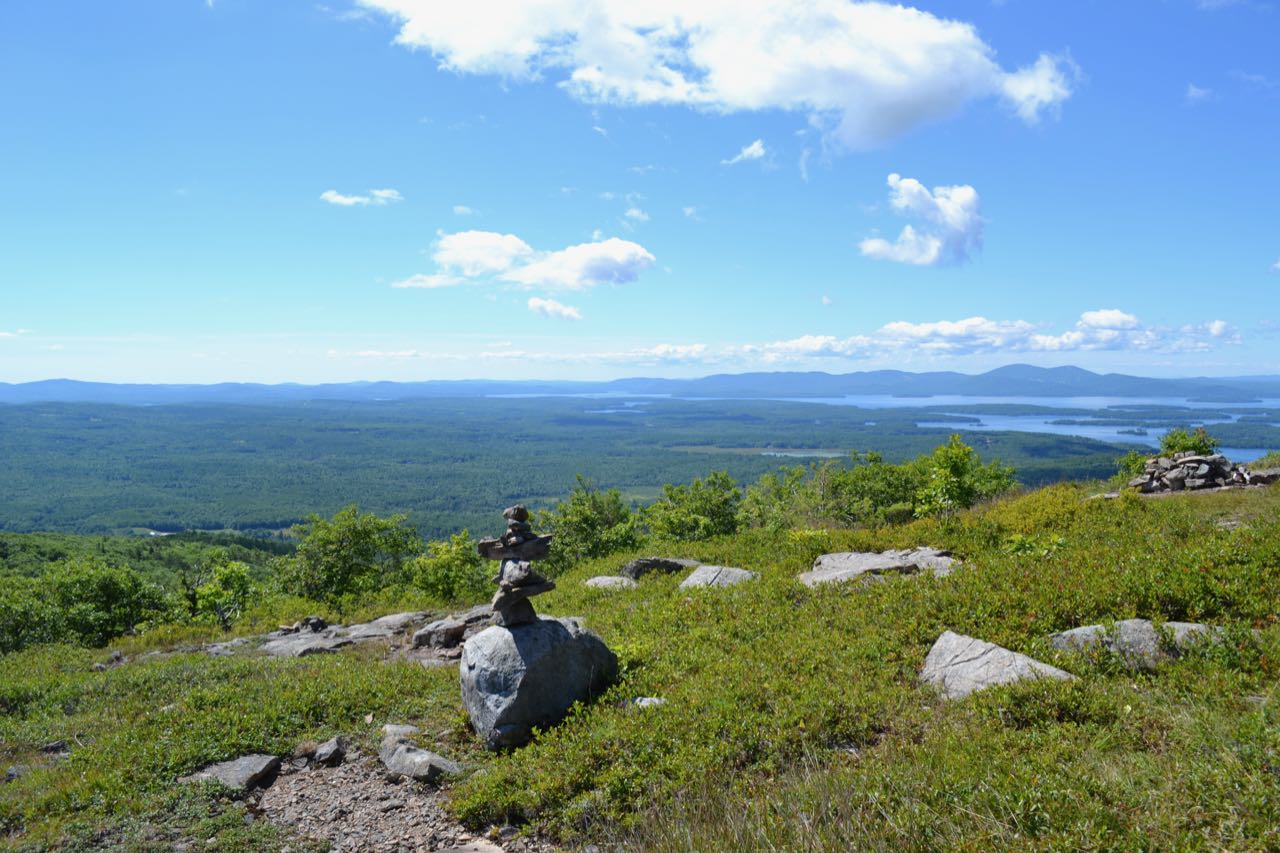
The trail begins in a small parking area at the beginning of a logging road. From the parking area, follow the logging road into the forest. This is Mt. Shaw Trail. There are no trail signs, so follow directions carefully. Many other logging paths diverge from the main one; make sure to stay straight. Soon, it meets Fields Brook at a pleasant little cascade. The logging road then continues to another cascade and forks, 0.4 miles from the parking area. Bear right onto Tate Mountain Trail, watching for the red and green striped blazes. The beginning of this trail passes many different logging roads and paths on its steady climb up the mountainside, so it is helpful to stop at each intersection and look for blazes, which are always present. Four notable intersections occur; the first one is just a short distance after turning onto this trail - you should stay straight as another road heads downhill to the right. At the second, 0.2 miles in, proceed straight across a four-way intersection. The third intersection is not far past the second, and you should bear right at a fork. The fourth intersection is half a mile in; bear right again at a fork. After this confusing section, the path becomes a less ambiguous forest trail. After a total of 0.8 miles on this trail, the trail comes out onto intermittent ledges, with increasingly good views over the trees. Follow the trail for 0.4 miles further across these ledges to its end at Banana Trail, which is marked with blue blazes and has a sign facing away from you (pointing the way back to the trailhead). Bear right and follow the Banana Trail for a short distance to get to the Big Ball Mountain viewpoint, where you are rewarded with a fine 180-degree viewpoint to the south at the Belknap Range and Lake Winnipesaukee, to the southeast at the Moose Mountains, and to the east at Dan Hole Pond. Retrace your steps back to the junction and bear right to continue the other direction on Banana Trail. It passes over the south peak of Big Ball Mountain in 0.1 miles, dips slightly, and ascends to the ledgy summit in another 0.2 miles, where there is another good viewpoint with views to the west of nearby Bald Knob and up at Black Snout.
Printable directions page